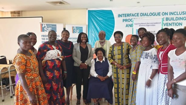
Understanding Land Rights Situation in Nwoya District: A reflection from PELARD-N Inception Meeting
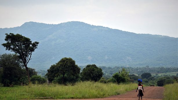
Curved out of Amuru, Nwoya district – part of Acholi sub-region, was established by the Act of Parliament on the 1st July 2010. Of late, the district has come to lime light and center of attraction for the numerous natural resources that it has such as the Murchison falls on the River Nile, Murchison Falls Protected Areas and the Murchison Falls National Game Park, Lake Albert and the oil rich Western Rift Valley – the Albertine Graben and the fertile lands. According to National Housing and Population Census of 2014, Nwoya as a district had a total population of 133,506 people with 50.6% being females and 58.2% being young people below the ages of 18 years. Gifted with fertile soils it is noted that 94% of the total population in Nwoya district is engaged in crop farming, making land a very vital asset crucial for livelihood. With the current state of Covid 19 it has been stated that land related disputes still continues to affect the peace of many. What has been realized is that concluded phases of return and resettlement as a result of the protracted conflict in northern Uganda created a huge shift in land ownership with individuals instead of clans owning land, controlling, transferring and taking charge of land transactions and those not handled properly resulting into disputes
Situating Land Governance and the Legal Frameworks in Uganda.
Uganda as a country is known for its popular dual legal frame works for land governance. These frameworks includes the 1995 Constitutions of the Republic of Uganda and the 1998 Land Act that formalized the legal pluralism and also by explicitly recognizing customary rights to property, while also strengthening the protection of land rights. Critical is that since return, resettlement, recovery and development, land governance in customary forms still continues to greatly determine land and property rights in the entire Acholi Sub-region. According to the Senior Land Management Officer, land in Nwoya district is held under three land tenure systems and these includes; customary, leasehold and freehold which defines the different land rights including ownership, access and control and the resultant obligations as holders of land rights such as the payment of premium and ground rent.
Challenging is that most community members do not easily understand the legal regimes relating to land tenure in Uganda due to illiteracy and little or no access to information relating to such . Historically, it has been noted, that customary tenure has continuously and significantly been based on occupation rights and utilization rather than ownership. One of the tenets of the tenure is that there is always a land-leader. The land leader‘s key responsibility is to ensure that whoever wishes to utilize the land has access and rights to protect the land from any intrusion, trespass or abuse. In this sense therefore, she/he shoulders the responsibility for utilization rights and accessibility interests for individuals, families, sub-clans and clans – a common practice in most customarily owned land in Northern Uganda. For example, the Ker Kal Kwaro Acholi has instituted sets of Principles, Rights and Responsibilities (PRR) within which land matters are guided and provide for the rights of vulnerable groups. However these principles are not well rolled out.

The Unresolved Dispute and Contestations in former Aswa Lolim Game Reserve in Nwoya District.
Interactions with a few stake holders indicated that there are considerable efforts being made towards the promotion of development in Northern Uganda. However, in some parts of the region development efforts are yet being threatened and delayed by land disputes. The is compounded by the misinterpretation of the customary land tenure system; retracted land gifts as commonly noted that relatives are claiming back gifted lands; the breakdown of social fabric; absence of clear boundary demarcation; lack of uniform guidelines and practices relating to the customary tenure; creation of new districts with unclear boundaries or boarder; and drive for investments and economic revitalization such as discovery of oil fields and minerals.
According to secondary data, about 80% land in Northern Uganda is customarily owned. Though there are no codified laws regarding the usage and management of customary land, social governance and tradition have long guided the people of the north, dictating how land resources can be used and managed. However, the existing land management structures and land dispute resolution mechanisms (both formal and informal) face huge financial and human resource shortages, hindering their effectiveness. Many appreciate and recognize that development is important for the region, but those who have already been impoverished by the war are afraid of land grabbing by the state and investment interests.
Nwoya as district is known for currently drawing in a number of individuals expressing interest to own land for investments and development and as such the district is said to be facing a number of land disputes. However, mentioned herein and of interest is the former Aswa Lolim Game Reserve. The former Aswa – Lolim game reserve is said to cover the areas of Lungulu and Got Apwoyo sub-counties. The place is said to have a total land mass of 40 square miles on the Eastern Banks of the River Nile. Formerly a game reserve, the area is said to have been degazetted in 1972 and currently it is under the control and management of Nwoya District Land Board. It has been noted that currently a number of individuals are applying to Nwoya District Land Board for land allocation and acquisition of legal rights. It is also noted that because of its vastness and fertility, this land has become a key attraction for commercial farmers in the district. The area is also said to be witnessing a number of conflicts with many still unresolved with these conflicts have historical roots between tribes, clans and individuals. Majorly, it is stated that a number of individuals are scrambling over land allocation and acquisitions in the area making the area to become a highly contentious land conflict hot spot.

Interventions for Securing Land Rights in Nwoya District
In the face of the numerous and unresolved land disputes in Nwoya district, the District Lands Office, the District Land Board, Area Land Committees and offices of the recorders at the district and Sub-county levels have been critical in guaranteeing provision of land related services in Nwoya. Other than the local government, other development partners such as ZOA, Ministry of Lands Housing and Urban Development, Acholi Religious Leaders Peace Initiative and International Justice Mission (IJM) have been at the fore front of implementing projects that promotes securing land rights in Nwoya district. GWED-G as an institution has been accredited for its roles in mediating over 120 cases under a Democratic Governance Facility (DGF) fund between 2018 and 2019. From June 2015 to 2018, the Land Security and Economic Development project was implemented in Nwoya district aiming at unlocking the economic potential. This was done through community –led land dispute mediation and customary – based land tenure registration. The Land Security and Economic Development project was intended to protect the most vulnerable community members and their land rights and in particular women and persons with disabilities. The project is said to have contributed securing the land rights of women and persons with disabilities through:
- Mapping of parcels and collection of geo-spatial and personal tenure information in systematic manner and peaceful resolution of land disputes through community based approaches.
- Provision of legal documentation to secure land rights resulting into massive reduction of land disputes within the communities, by averting land boundary disputes. As such a number of land registration applications and thousands of hectares of land have been demarcated as recorded below:
- In Lungulu Sub-county, a total of 1082 applications for Certificate of Customary Land Ownership (COC) and 10400 Hectares of land have been demarcated. Demarcation per-say is a titling process used by the Area Land Committees in determining land boundaries and placing of boundary marks by Area Land Committees during the process of obtaining COC.
- In Alero Sub-county, 1394 applications for COC and a total of 14001 Hectares of land demarcated.
- In Anaka Sub-county, 532 applications and 395 parcels demarcated totaling to 1706.034 Hectares of land demarcated.
- In Purongo Sub-county, 56 application with 40 parcels demarcated totaling to 998.523 Hectares of land demarcated.
- In Koch Goma Sub-county, 421 applications for COC, 393 parcels demarcated totaling to 4283.433 Hectares of land.
- In Lii Sub-county, 493 applications, 419 parcels demarcated totaling to 2539.659 Hectares of land.
Other than the stated contributions from the Land Security and Economic Development project, it has been documented that Nwoya district land board has held 27 meetings to consider applications for registration of rights on land. This is said to have resulted into the formal documentation of customary land rights, leasehold rights and freehold land rights on massive scale. As a result, a total of over 600 applications for leasehold, and freehold and over 2500 applications for Certificate of Customary Ownership as of June 2020 have been documented. Currently, Nwoya as a district has a functional formal court system that handles all land related matters and disputes, creating a huge shift in the administration of land justice and easing access to justice to the locals as it was before. Previously, it was noted that the locals had to access the court in Gulu in search for justice. However, with a court and a government prison that is fully operational, court and court related services is said to have become more accessible and cheap, and this has translated into improved access to justice in the district.
Conclusively, land in this part of Uganda previously, had significantly unrecognized wealth and value. Today, the land is known for its fertility, and of late, the mineral-rich nature of this land has incentivized interest and investment in the area. Increasing land value has created a huge shift and debate around land ownership, access and user rights. Additionally, land, oil, forests and game reserves in and around the Murchison Falls Game Park has continued to shape the political, social and economic relationship between individuals and the state, a reality that cannot be undermine. PELARD-N is a European Union (EU) funded project that – Protection and Empowerment of Land Rights Defenders in Northern Uganda.


